Because the files are large and contain an extensive amount of data we have provided a sample of the reports and the information they contain. To request a copy of the following reports, please email Lou Baker bakerl@wsdot.wa.gov. If you have any questions please give him a call at 360-570-2361.
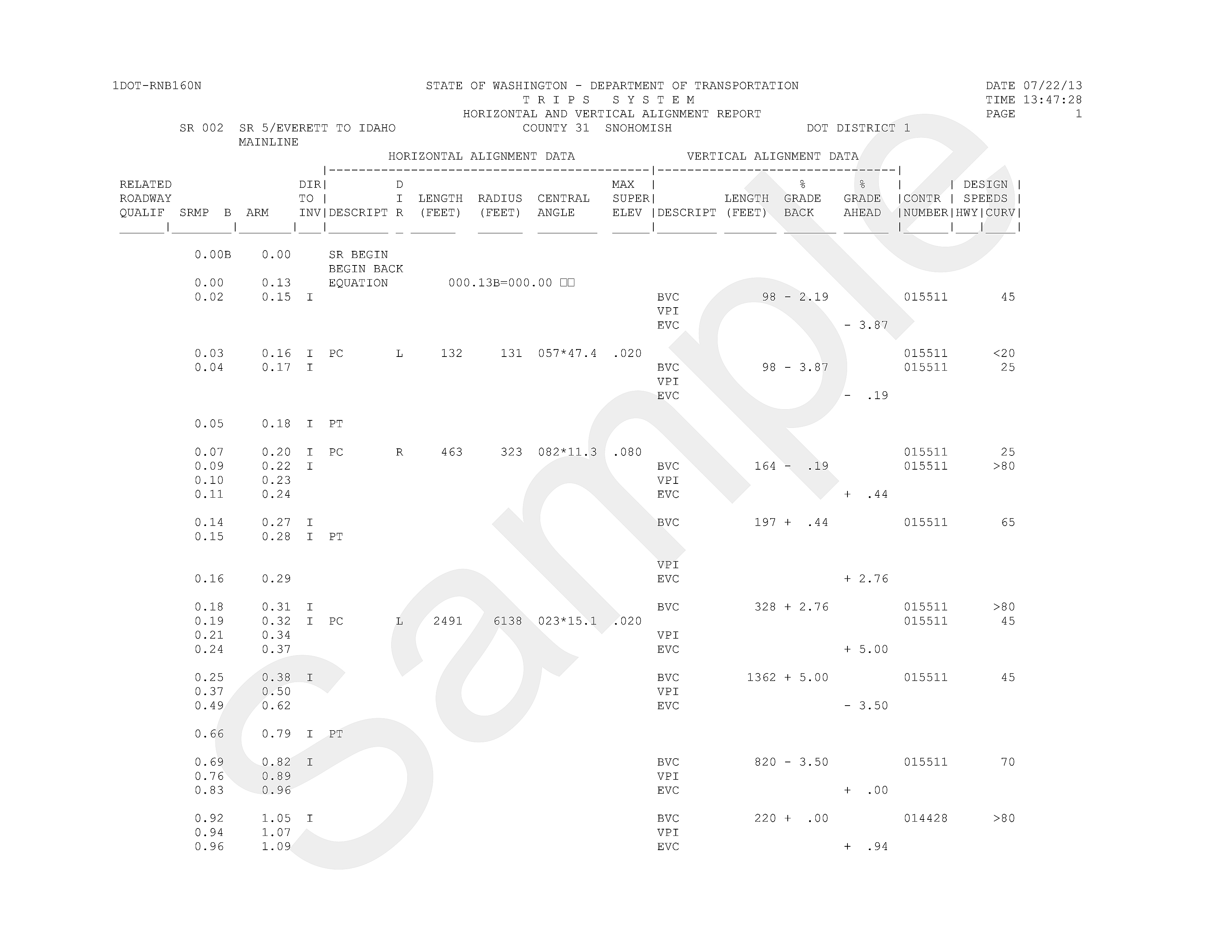
The Horizontal and Vertical Alignment Report contains curve data extracted from state highway construction contracts. The horizontal data includes curve direction, length, radius, central angle and super elevation. The vertical data includes vertical point of intersection, percent of grade ahead and back and curve length.
 |
|
Horizontal and Vertical Alignment Report |
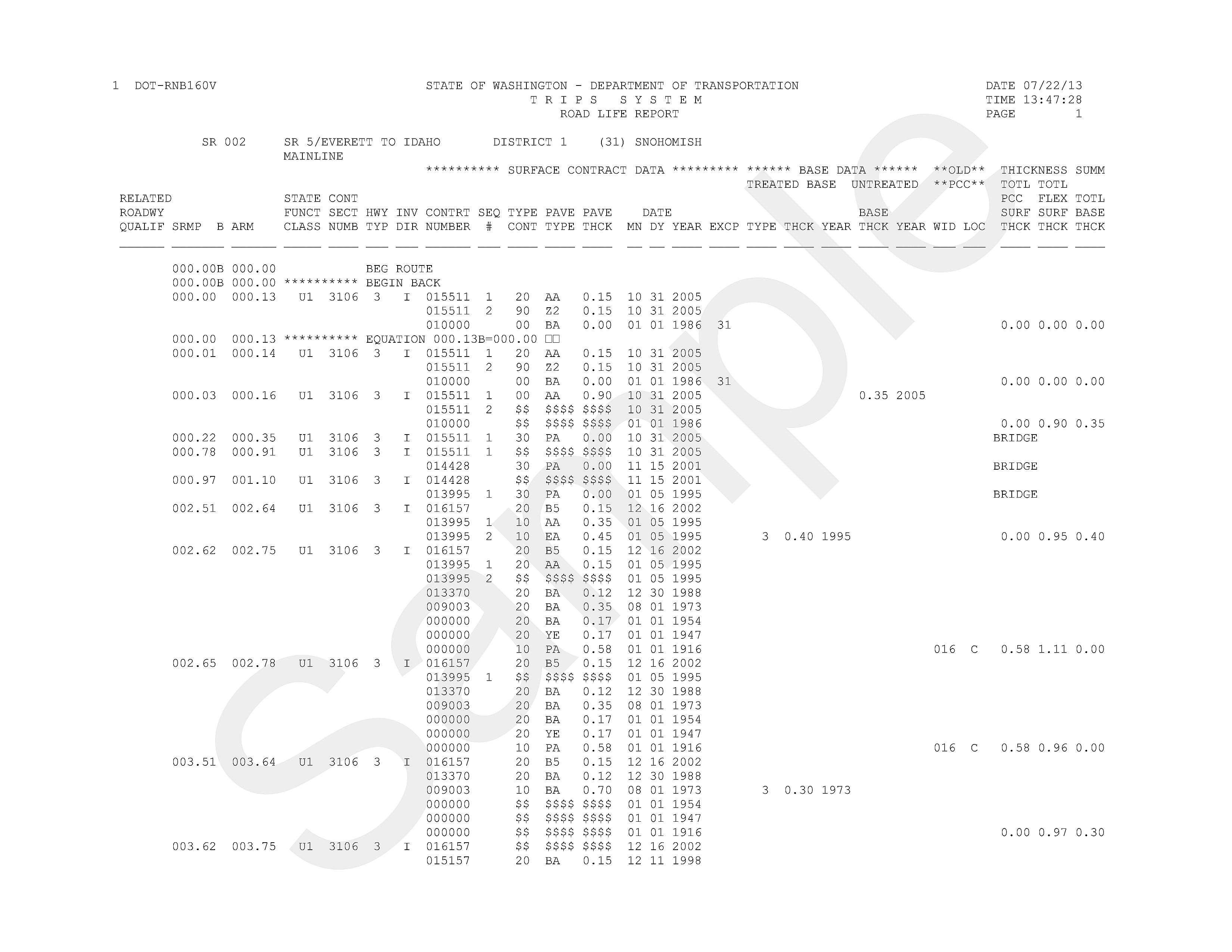
The Road Life Report contains coded historical contract information on all state routes, e.g., resurfacing, reconstruction, bridge widening and replacement, lanes added etc. This serves as the primary data source for the Washington State Pavement Management System (WSPMS), which assists pavement managers in forecasting highway construction projects.
 |
|
Road Life Report |
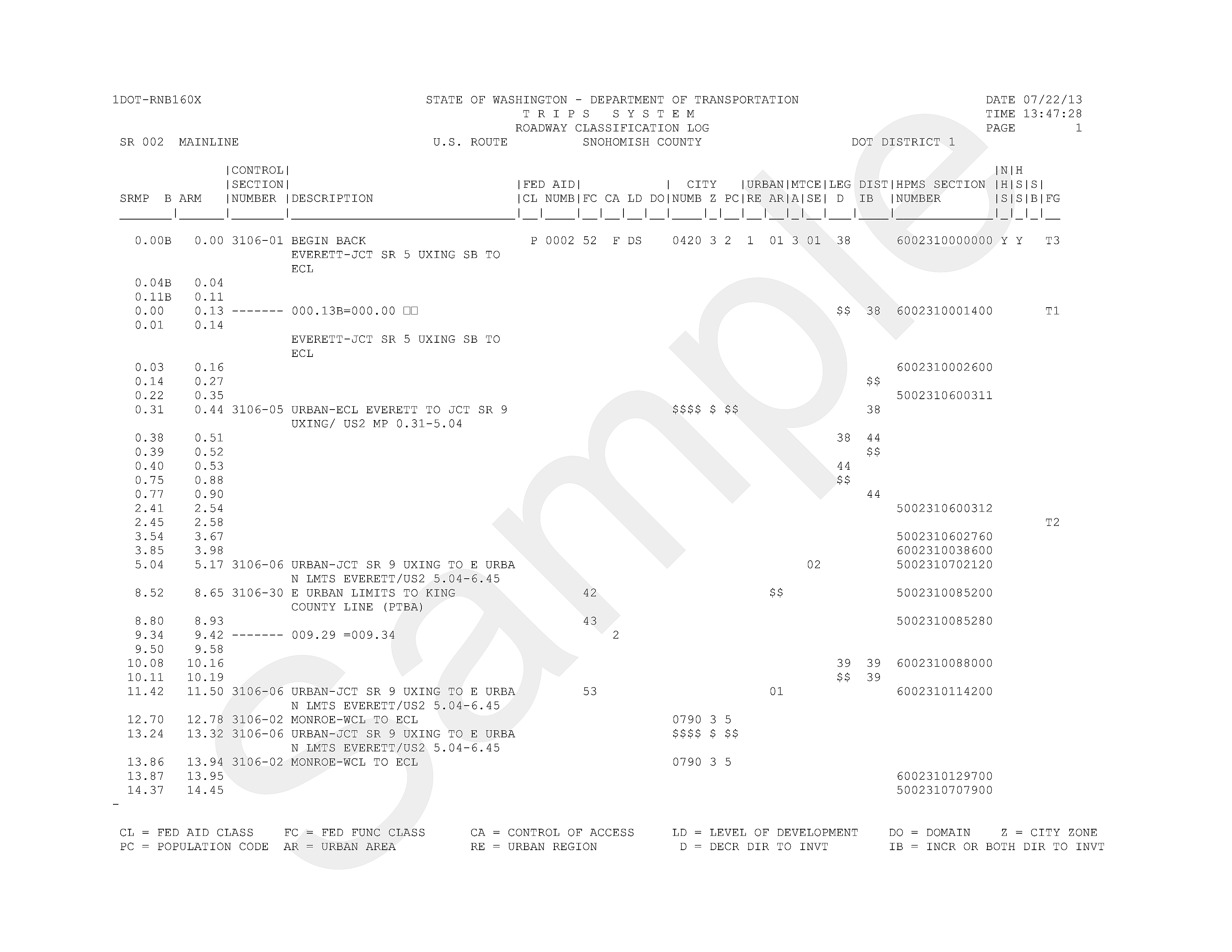
The Highway Classification Log is a listing maintained in Transportation Information and Planning Support (TRIPS) which includes information about items such as control section, city and county, legislative districts, federal aid class/number, maintenance area, urban area/region, and Highway Performance Monitoring System (HPMS) section numbers.
 |
|
Highway Classification Log |