Minimum bid
$10,000.00
Zoning information
RDD-10, which permits 1 residential house per every 10 acres. Lewis County, 360-740-1146
Zoning description
The parcel is zoned RDD-10 by Lewis County.
Tax parcel number
Unassigned Right of Way adjacent to 034026012006 (for reference only)
Location and size
A 2.24+/- acre trapezoid shaped parcel that is located in a rural area of Lewis County, along SR-7. Parcel is land locked with no legal access.
Abbreviated legal and acquisitions information
Ptn. NE ¼ NE ¼, Sec. 35, T. 13N., R. 4E., W.M. The parcel was acquired by Warranty Deed recorded under Lewis Auditor File Number 733745
Improvements
None
Topography and cover
The subject site is wooded with various vegetation and is 15%-35% slope and lies within a 100-year flood plain and is affected by the shoreline stream from the Tilton River.
Utilities
No utilities on site. All standard utilities are available in the area, but will need to be extended to parcel when land is developed.
Special conditions
Parcel is land locked with no legal access. Parcel is affected by the shoreline environments of Rural or Urban Conservancy per Lewis County Shoreline Environment Designations, adopted September 21, 2021. For additional land usage requirements/restrictions, contact the local jurisdiction.
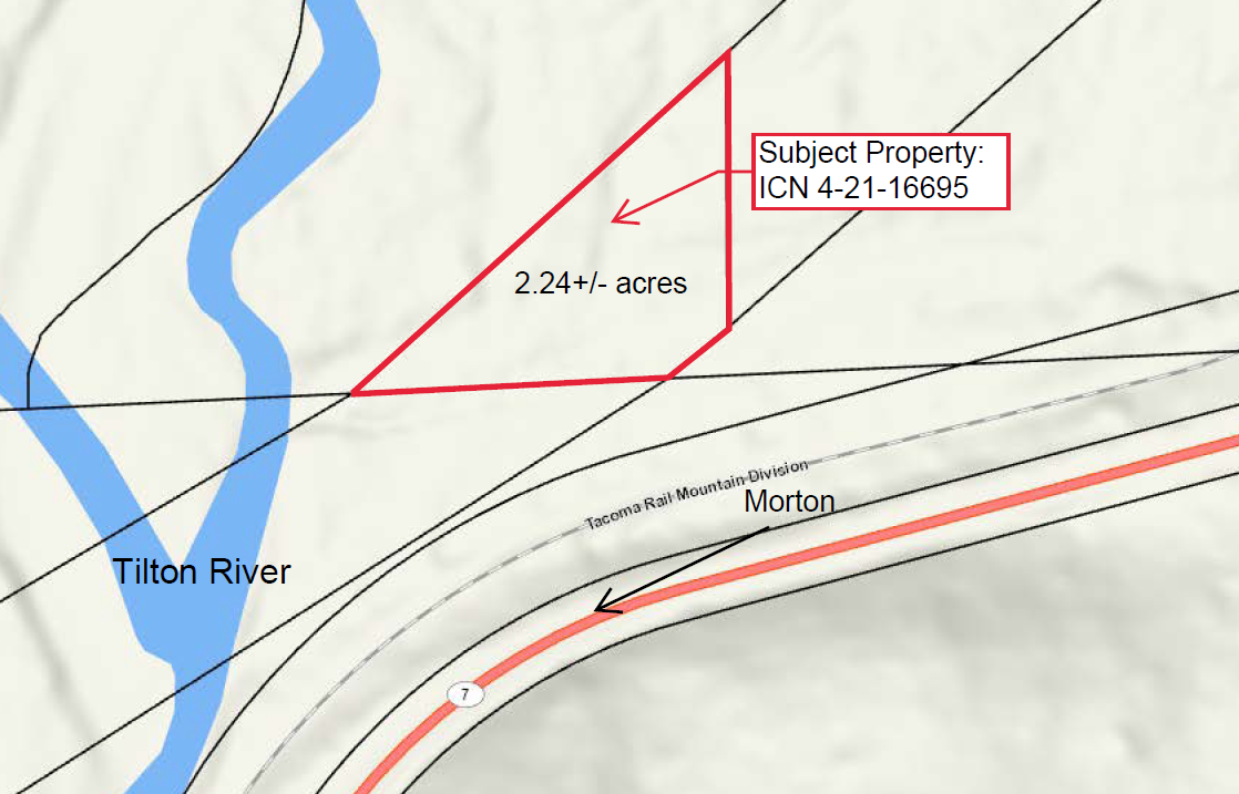
Map of parcel #4-21-16695, Lewis County
Contact
Greg Snelson