How do you want to travel?
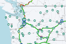
View data by road
See real-time alerts, cameras and restrictions in a list view by road.
Which road?
View alerts and cameras by route
View boarding status by terminal
Which airport?
Projects and improvements in your county.
Explore the progress of projects focused on creating safe and reliable ways to move people and goods around Washington.
County
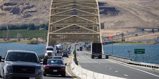
Featured Project
I-90 Vantage Bridge – Replace Bridge Deck and Special Repairs
Travelers crossing the Columbia River on I-90 will see lane closures over spring and summer as crews work to replace the entire surface of Vantage Bridge.
Access the resources you need to maintain and improve the transportation system.
Latest from WSDOT...
- SEATTLE – Washington State Ferries needs to replace the aging Fauntleroy ferry terminal to maintain safe and reliable ferry service for the 3 million people who travel the “Triangle” route between West Seattle, Vashon Island and the Kitsap Peninsula each year.
- SHINE – Travelers who use the State Route 104 Hood Canal Bridge overnight should prepare for a series of overnight closures in May and June as construction resumes on the bridge.
- Highway construction crews use TMAs in their traffic control plan because they are designed to absorb the energy of a collision if someone drives into it. The TMA also reduces damage and redirects traffic away from people in work areas.